
11 Jul 2019
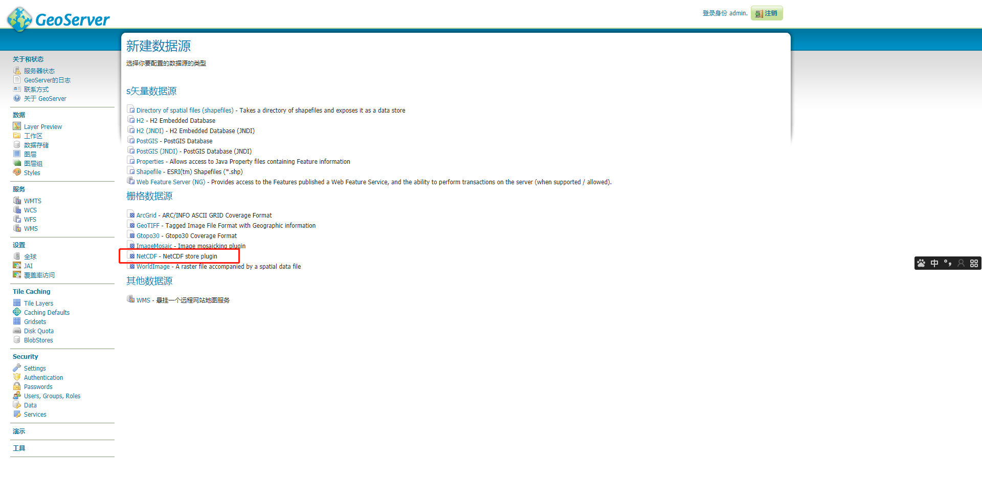
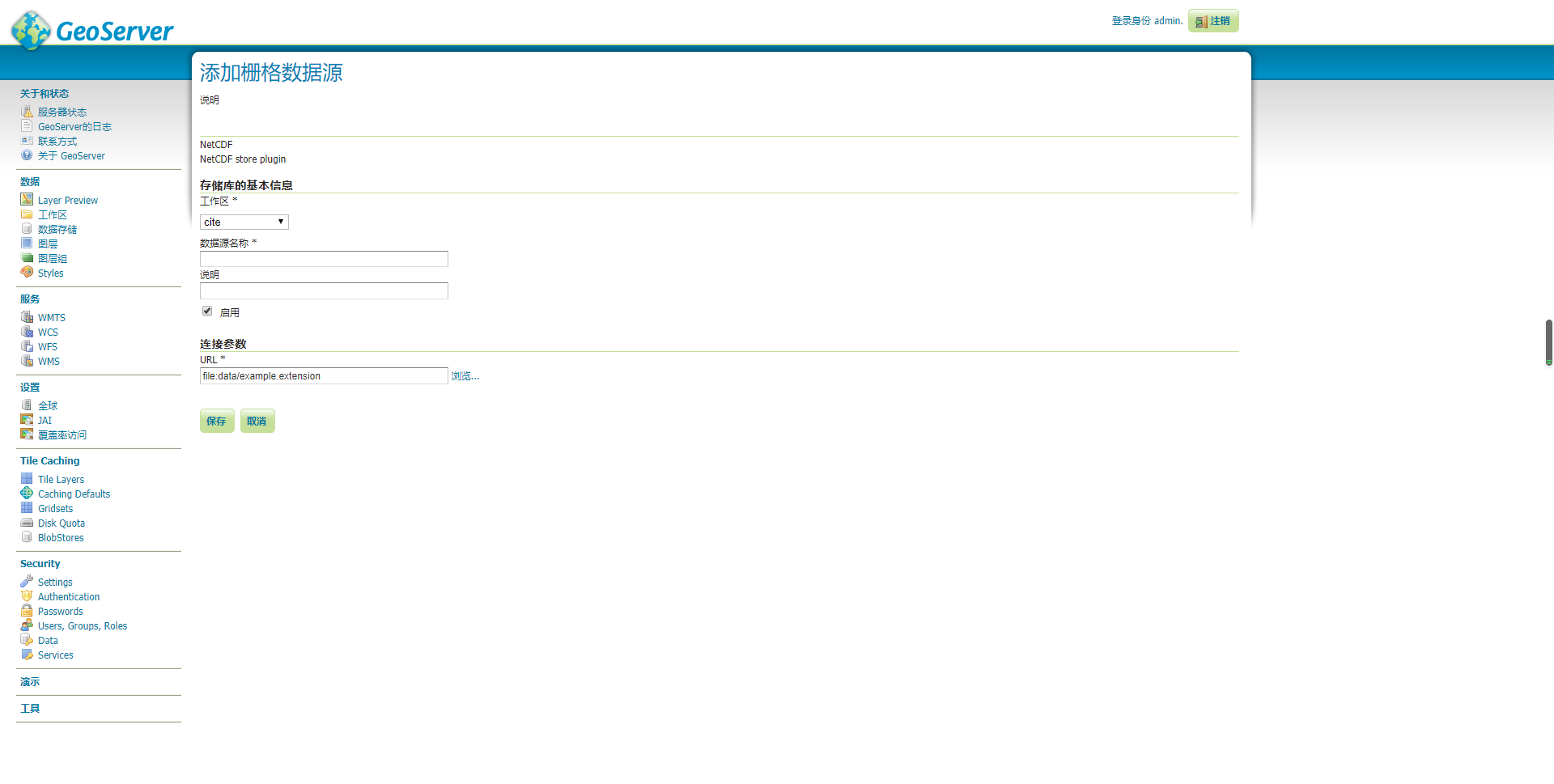
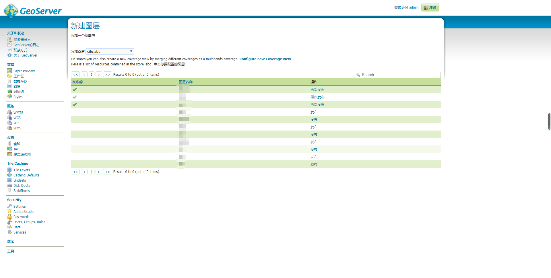
GeoServer 发布 NetCDF 气象文件
选择对应版本的下载地址:http://geoserver.org/release/2.11.0/
下载netcdf 的插件地址: http://sourceforge.net/projects/geoserver/files/GeoServer/2.11.0/extensions/geoserver-2.11.0-netcdf-out-plugin.zip
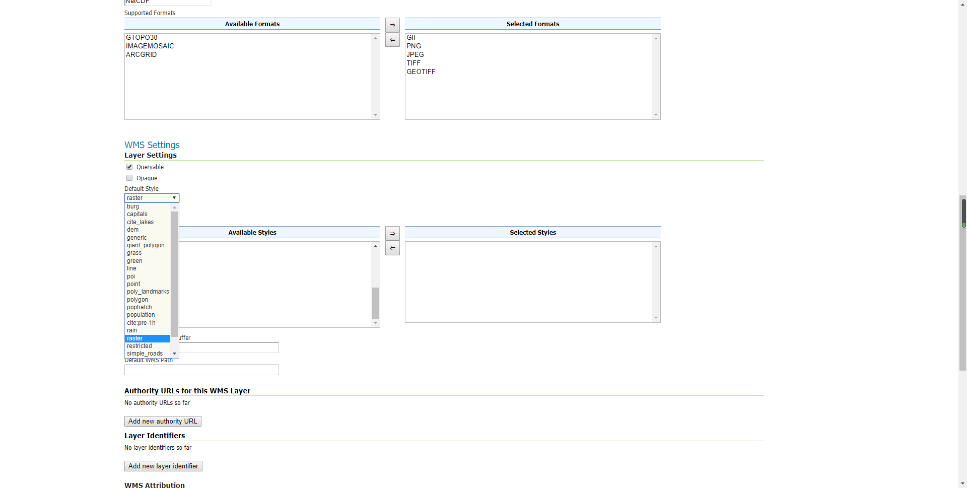
style :
        <?xml version="1.0" encoding="UTF-8"?>
        <StyledLayerDescriptor version="1.0.0" xmlns="http://www.opengis.net/sld" xmlns:ogc="http://www.opengis.net/ogc"
        xmlns:xlink="http://www.w3.org/1999/xlink" xmlns:xsi="http://www.w3.org/2001/XMLSchema-instance"
        xsi:schemaLocation="http://www.opengis.net/sld http://schemas.opengis.net/sld/1.0.0/StyledLayerDescriptor.xsd">
        <NamedLayer>
            <Name>gtopo</Name>
            <UserStyle>
            <Name>dem</Name>
            <Title>Simple DEM style</Title>
            <Abstract>Classic elevation color progression</Abstract>
            <FeatureTypeStyle>
                <Rule>
                <RasterSymbolizer>
                    <Opacity>1.0</Opacity>
                    <ColorMap>
                    <ColorMapEntry color="#AAFFAA" quantity="0" label="values" />
                    <ColorMapEntry color="#00FF00" quantity="1"/>
                    <ColorMapEntry color="#FFFF00" quantity="5" label="values" />
                    <ColorMapEntry color="#FF7F00" quantity="10" label="values" />
                    <ColorMapEntry color="#BF7F3F" quantity="20" label="values" />
                    <ColorMapEntry color="#000000" quantity="40" label="values" />
                    </ColorMap>
                </RasterSymbolizer>
                </Rule>
            </FeatureTypeStyle>
            </UserStyle>
        </NamedLayer>
        </StyledLayerDescriptor>
叠加到地图上:
        <!DOCTYPE html>
        <html lang="en">

        <head>
            <meta charset="UTF-8">
            <meta name="viewport" content="width=device-width, initial-scale=1.0">
            <meta http-equiv="X-UA-Compatible" content="ie=edge">
            <title>openlayers</title>
            <link rel="stylesheet" href="https://openlayers.org/en/v4.6.5/css/ol.css" type="text/css">
            <script src="https://openlayers.org/en/v4.6.5/build/ol.js" type="text/javascript"></script>
            <script type="text/javascript" src="http://api.tianditu.gov.cn/api?v=4.0&tk=98e9a2cdca443e8fdf95821acf89825f"></script>
            <style>
                .map {
                    position: absolute;  width: 100%; height: 100%;
                }
            </style>
            <script>
                function onLoad() {
                    var layers = [
                        new ol.layer.Tile({
                            title: "天地图矢量经纬度底图",
                            source: new ol.source.XYZ({
                                url: "http://t0.tianditu.com/DataServer?T=vec_c&x={x}&y={y}&l={z}"
                            })
                        })
                    ];
                    var map = new ol.Map({
                        layers: layers,
                        target: 'map',
                        view: new ol.View({
                            projection: 'EPSG:4326',
                            center: [116.38,39.93],
                            zoom: 5
                        }),
                        controls: ol.control.defaults({
                            attributionOptions: {
                                collapsible: false
                            }
                        })
                    });

                    var tianditu_cva_c = new ol.layer.Tile({
                        title: "天地图经纬度矢量注记",
                        source: new ol.source.XYZ({
                            // url: 'http://t0.tianditu.com/DataServer?T=cva_c&x={x}&y={y}&l={z}'
                            url: 'http://www.google.cn/maps/vt?lyrs=t@189,r@240000000&gl=cn&x={x}&y={y}&z={z}'
                        })
                    });
                    map.addLayer(tianditu_cva_c);
                    var geoserver_wms = new ol.layer.Tile({
                        source: new ol.source.TileWMS({
                            url: 'http://127.0.0.1:8080/geoserver/cite/wms',
                            params: {
                                'LAYERS': 'cite:PRE_1h', //此处可以是单个图层名称,也可以是图层组名称,或多个图层名称
                                'TILED': false
                            },
                            serverType: 'geoserver' //服务器类型
                        })
                    });
                    map.addLayer(geoserver_wms);
                }
            </script>
        </head>

        <body onload='onLoad()'>
            <div id='map'></div>
        </body>

        </html>
geoserver发布地图服务WMS https://www.jianshu.com/p/562ba61725ab
安装uDig:
https://www.cnblogs.com/marsprj/archive/2013/02/18/2915498.html
业精于勤,荒于嬉; 行成于思,毁于随。
pnunu
at 18:06